Bennington began as settlements along the Contoocook River, next to the Great Falls. As the town grew, the center of the village became the intersection of two State-owned roads: 2nd New Hampshire Turnpike, [aka: Route 31] linking the town to Greenfield and Hillsboro; Route 47, linking the town to Francestown; and Hancock Road, heading South then West to Hancock on Route 137. Also: Mill Road/Antrim Road, past the Paper Mill toward Antrim; and Old Greenfield Road, going South out of town toward Greenfield and Peterborough. In other words, Bennington was a major cross-roads — odd, especially when you think that the population was less than 700 people!
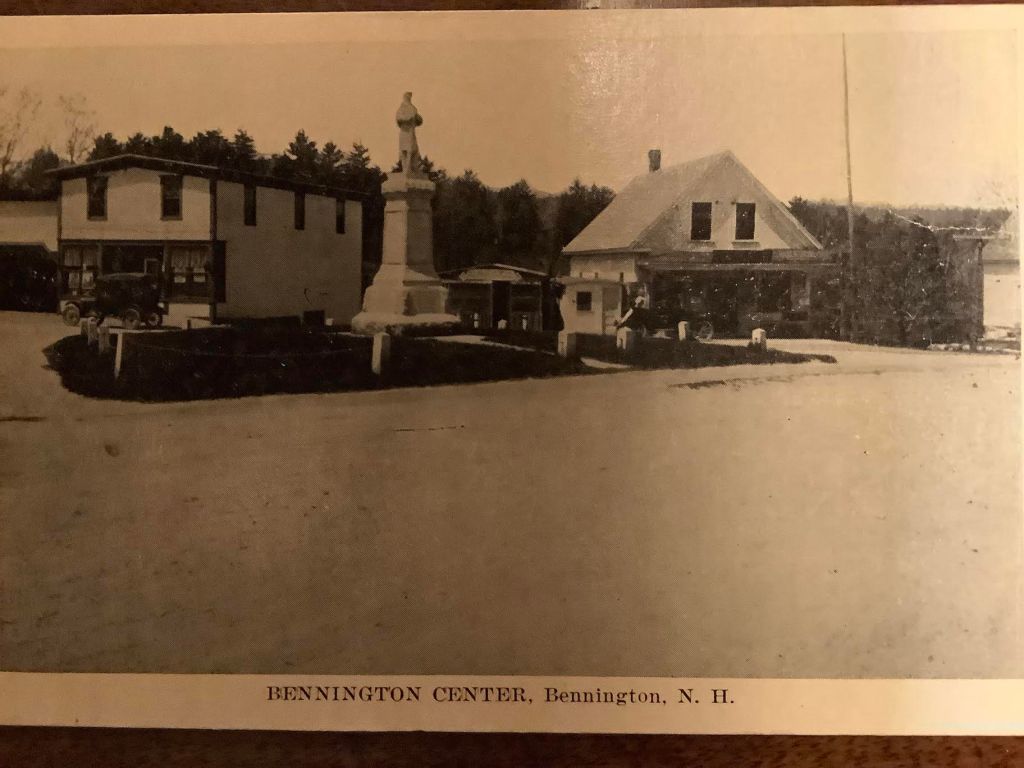
What did it look like then? The post card photo above shows a view looking North West at the center of the Village in the late 1930s. In the middle, is the Civil War Monument, erected in 1903 on a triangle of grass where most roads met. The street in the foreground, running lower left to middle right, is Main Street. The building seen at the left rear is Edmund’s Store, which originated as a ‘dry goods’ business in Bennington in 1936, before removing to Antrim. The building on the right rear was a pool hall and the very small building between them housed both an ice cream/candy store and a barber shop.
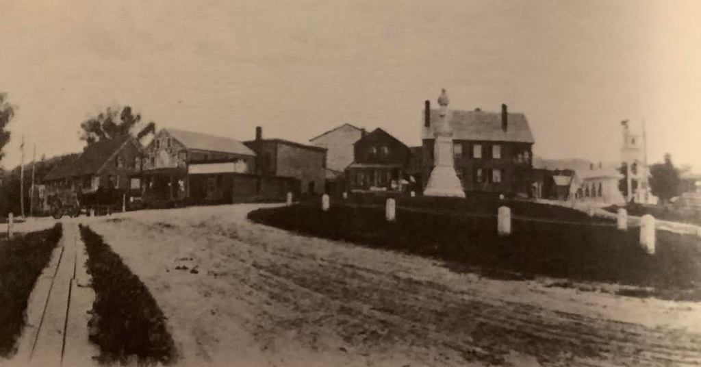
In this view of the town center, we can see the wooden sidewalk on the left, running North. Just behind the horse and wagon at the end of the sidewalk, we see the Crystal Spring House. To the right of it is Joslin’s Store, with its colorful facade. The large house with two chimneys behind the Civil War Monument is the Adams Hotel, and the white building in the upper right is the Congregational Church.
The next installment will be posted on April 17. If you click the Follow button, all future posts will be sent straight to your inbox every month.
