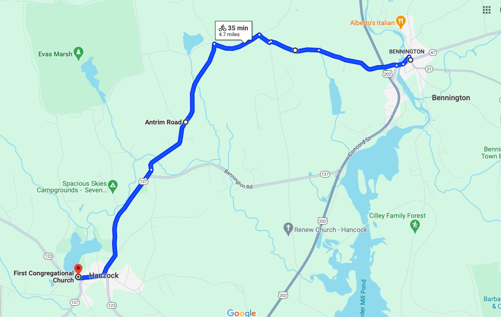
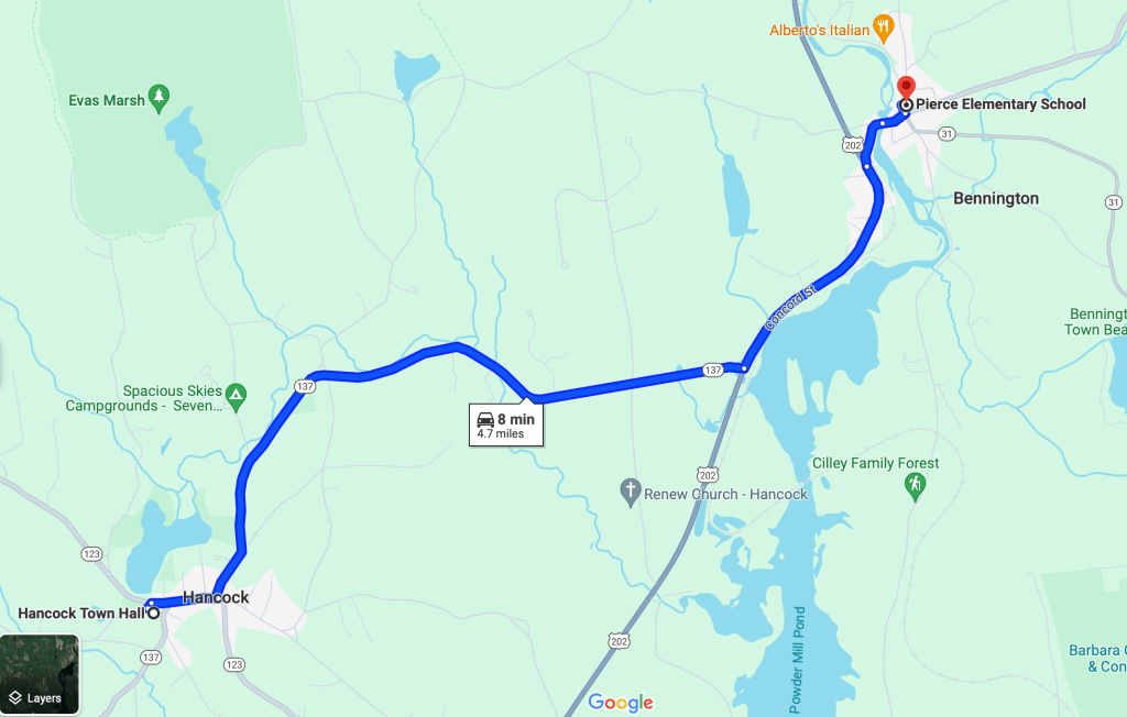
One of the most important roads in early Bennington was the road to Hancock. Until 1842, Bennington was part of Hancock, so if you had to go “to town,” that was the town you were going to. Nowadays, it takes eight minutes to drive the 4.7 miles, but in 1820, you would have gone by horse or wagon or on foot — and it would have taken a lot longer. Remember, that there was no US Route 202 in those days, so there were two ways to go, both over back roads. The Google Map screen shots below show both the approximate routes. Hancock Road was the better route, since it did not involve climbing steep Pierce Hill, but it tended to be much muddier when wet due to proximity to the river.
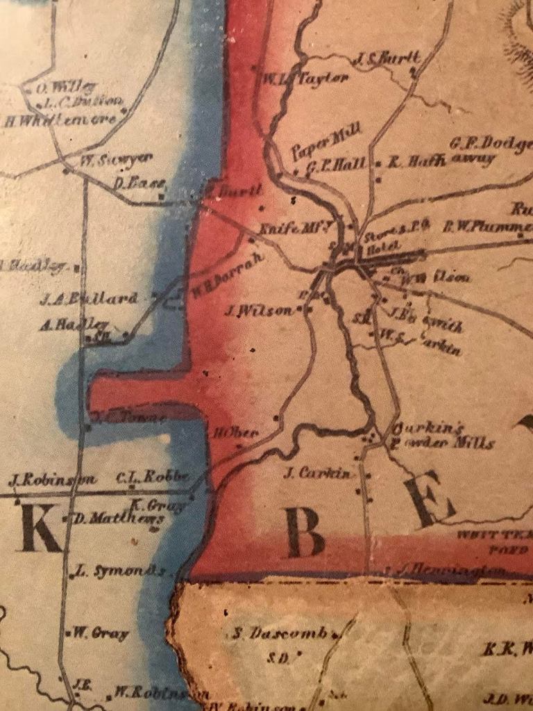
Today, “Hancock Road” in Bennington runs from the former Bennington Train Station south-west along the river to join what is now Route 202 West. The 1858 map below shows the full extent of the route, trending south-west, past the houses of J. Wilson and H. Ober, then taking a right onto what is now NH 137, which leads to the center of Hancock. It was a bucolic unpaved road, suitable for horse travel or pedestrians. In the Summer, it would be shaded but dusty. In the Winter, it would be snow-covered and drifted. In Mud Season, it would be impassable.

Imagine having to travel that distance to attend church on Sunday, to go to the Town Office to pay taxes or to speak to a Select Man — it would be an all-day excursion! In a time when people were self-employed [as farmers] or were on a factory payroll, there was no time to travel the Hancock Road for a less-than-serious reason.
The next installment of the Bennington NH Historical Society Blog will be posted on February 26, 2024. If you click the Follow button, all future posts will be sent straight to your inbox every month.
