Architecture styles change over time, showing the preferences of the people based on convenience, availability of materials, and outside influences. Bennington is no different. From the late 1700s to 1910, there were eight recognizable styles of houses were built in our town. The oldest is the Cape.
House Beautiful.com describes a Cape-style house this way: “…modest, one-room deep, wood-framed houses with clapboard or shingle exteriors (which, when weathered over time, turned that quintessential light gray color). They were low, broad structures with unadorned, flat-front facades….The classic Cape Cod cottage had a central front door with two windows on each side of it…The homes often had a large central chimney that linked to several rooms in the house, with a steeply pitched, side-gabled roof (meaning the triangular portions of the roof are on the sides of the house), which helped prevent snow accumulation. The ceilings of the single-story homes were low, which kept things cozy and also helped to keep living quarters warm.”
The oldest houses in Bennington date from the 1790s, and they are all Cape-style. It is said that many of the houses on Main Street were built by John Putnam, to encourage families to move to the area.
From OldHouseonline.com
The floor plan at left shows the typical lay-out of the time: only three main rooms downstairs, around the central chimney. A ‘keeping room’ would be called the kitchen today or a ‘great room’/family room in modern decorating parlance. It was the warmest room in the house. That was where the cooking, eating, and everyday life occurred. The four rooms flanking the keeping room were for two pantries; a bedroom for a guest; a smaller bedroom for a family invalid, or servant. The stairs lead to a loft for storage and for children’s sleeping quarters as the family grew.
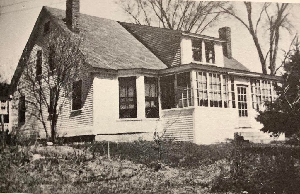
Balch Farm House
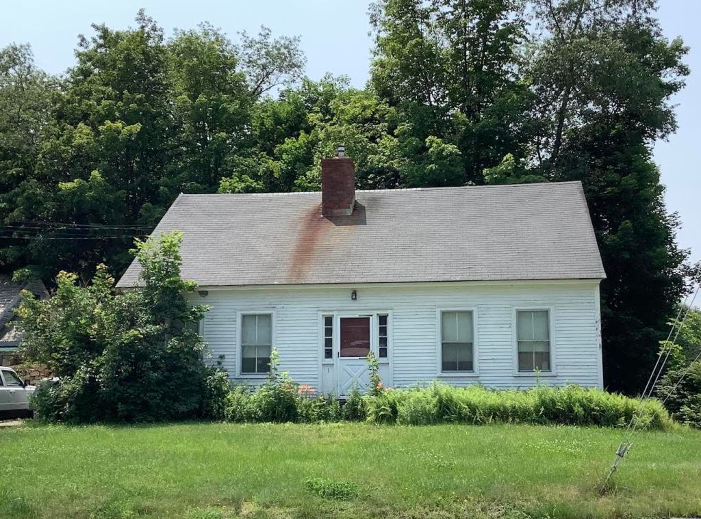
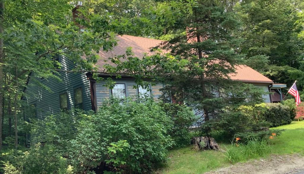
We are fortunate that some of our oldest houses still stand, such as the Putnam House; Balch Farm house near the top of Bible Hill Road [which was being restored in 1979, when it caught fire from a purported lightning strike, and was almost completely destroyed]; and the many Cape-style houses near the Village Center, like the one below on Bible Hill Road, sometimes called the Burtt House, after its builder.
One of two old Capes, almost across the road from each other, on Bible Hill Road near the Village Center.
The next installment of the Bennington NH Historical Society Blog will be posted on September 18, 2023. If you click the Follow button, all future posts will be sent straight to your inbox every month.
When Bennington, New Hampshire was just a cluster of raw-wood houses in the 1790s, there was no place to go to church. When the area was called Factory Village, a family could journey to attend the Congregational Church of Hancock, but that was a long trip, impassible in winter or Mud Season. Most families probably held home-based religious activities on Sundays: prayers, scripture readings, hymn singing. In 1833, a group of town worthies banded together for worship as the Union Trinitarian Congregational Society, meeting in private homes for worship.
From then on, there was a push to build a church to serve those who lived on the banks of the Contoocook River. Congregationalism as a church movement, descended from Puritans who thought that each church should run its own affairs, unbeholding to the dictates of people elsewhere. By that time, citizens of what-would-become Bennington were feeling stirrings of independence, so a Congregational church would have been a good fit. Evangelical churches [Congregational, Methodist, Presbyterian] were part of the Second Great Awakening of religion in the1800s in the US. This lead to buildings that were not ornate and soaring, like Gothic or Georgian-style churches.
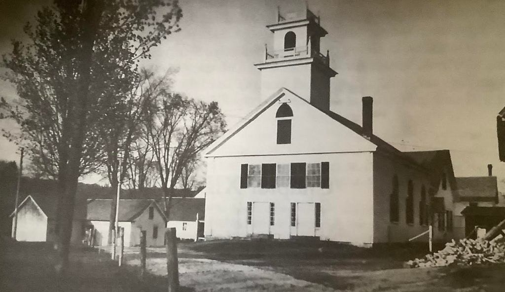
The church building was constructed in the Village Center on the corner of Main Street and Francestown Road in 1839. To pay for it, families would pledge money and sweat-equity to put up the House of God. The style is a simple, gable-end structure. The steeple was the tallest structure in town. A pair of front doors lead into an entry vestibule, thence into the nave. Oddly, the boundary line between the Town of Hancock and the unincorporated Factory Village ran right along the front of the building. When entering the church, one stepped out of Hancock and into Factory Village.
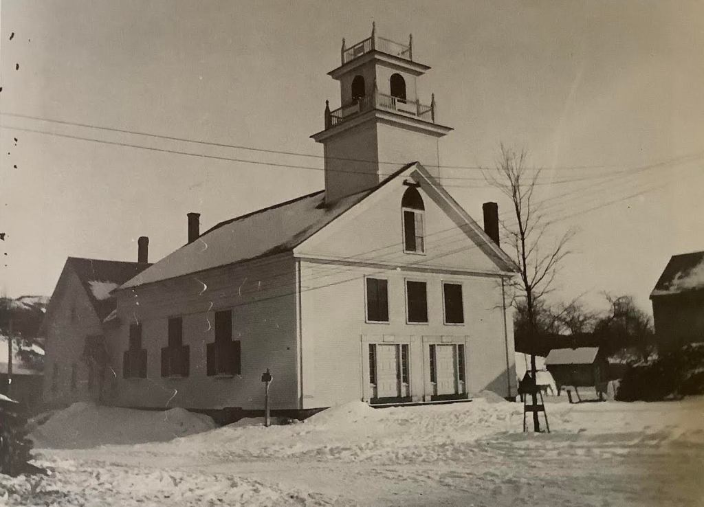
Winter view of the church, most likely from the early 1900s. Note the electric lines and the attached vestry at back.Church before 1947, with old Vestry as the small building on the left.
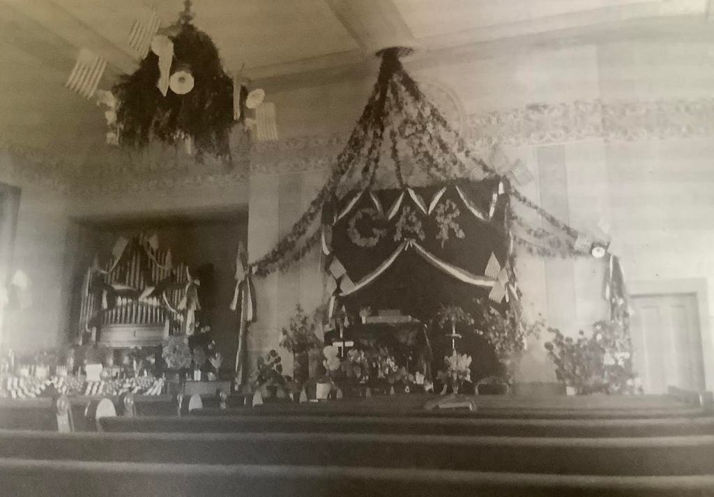
The nave is a 58’x50′ rectangle with a high ceiling. There was a balcony in the back where the choir sat. At first, there was no church organ and music was provided by two violins and a viola. Coming to church was often the social event of the week. There were two 90-minute services each Sunday, with an hour break in-between. During that time, the children attended Sunday School, everyone had lunch and a good tongue-wag.
The Parsonage, 1884.
In 1984, a parsonage was built by George Burns. Some of the ministers of the church included: Rev Ebeneezer Coleman; Rev. Albert Manson; Rev. James Holmes; Rev. Josiah Heald; Dr. Thomas Billings; Rev. Reginald Merrifield; Rev. William Clark, Jr; Rev. Marie Tolander; Rev. Fay Gemmell; Rev. Daniel Poling.
In 1853, a subscription was held to buy a bell for the steeple. In 1896, the small vestry building across the street was abandoned in favor of a set of attached rooms at the back of the church: kitchen, ladies’ parlor, wash room, small chapel. In 1899, a reed organ was installed. In 1917, a clock was donated for the steeple. The church interior was changed in the 1970s. With the lowering of the ceiling, the balcony was walled off.
Today, the church still holds services, with a revolving slate of ministers. The parsonage was sold off in 1977.
The next installment of the Bennington NH Historical Society Blog will be posted on July 31. If you click the Follow button, all future posts will be sent straight to your inbox every month.
Since ancient times, the wealthy of the cities would flee to the hills of the countryside in the summer for a cooler, leafier life. In New England, one knows of Newport, Rhode Island and the Berkshires of Massachusetts as being the resorts of the rich. Add to that, Bennington, New Hampshire. There were the hotels in the Village Center of course, the Adams Hotel and the Crystal Springs Hotel, but there was also a thriving business of farms that took in Summer People.
A summer sojourn in the country took on a new impetus in the mid-1800s, as popular novels [Heidi, Secret Garden], medical professionals [Florence Nightingale], and social reformers [Fresh Air Fund] touted the healing powers of nature and the importance of fresh air. The growth of railroads made travel to ‘remote’ areas possible.
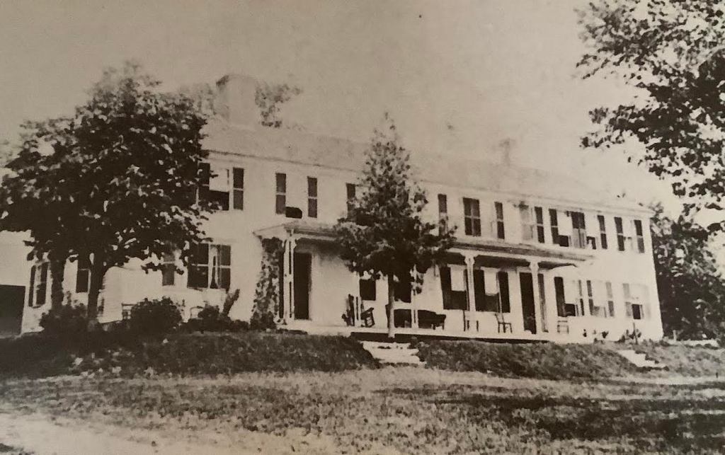
After the Civil War, farming slumped in northern New England, so a new income stream was devised. Farm wives were accustomed to cooking for large groups: their family, the laborers who helped with farm work — so why not take in summer borders? As people came from the cities in the summer, farms added a wing of rooms to accommodate them. Meals would be served communally three times a day, and transportation to and from the railroad station was provided. What did the Summer People do all day? Read on the veranda, take nature walks, pick berries, write letters, and relax. Among the farms that took in visitors were the Dodge House atop Dodge Hill Road, with panoramic views:
The Dodge House, now owned by the Warren Family, was the largest and oldest farm in town. The extensions to the original late 1700s farmhouse were added in 1878 and 1884.
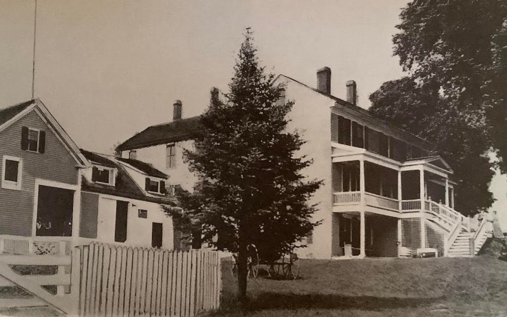
Colby-Green near-by on Larkin Road:
Built in 1795, the Colby family built the porch in the 1880’s and advertised as a summer resort called Colby-Green.
and Favor Farm on the Francestown Road with views of Crotched Mountain.
Favor Farm, is said to have been built from a kit — the sort that Sears Roebuck would send to you. Later, the Blanchard Family farmed here.
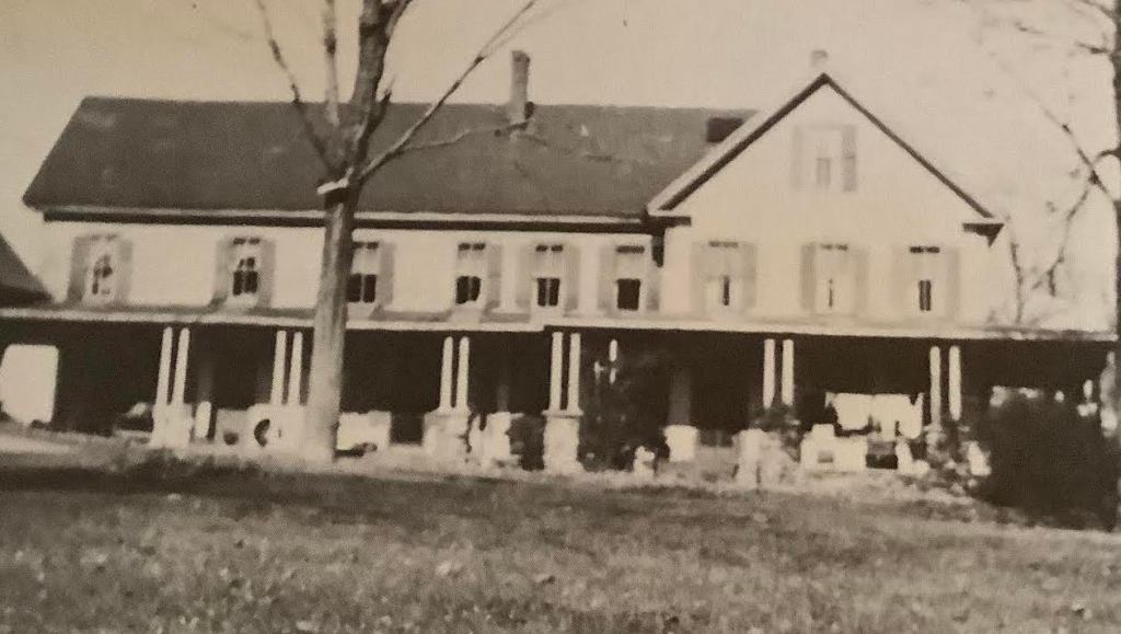
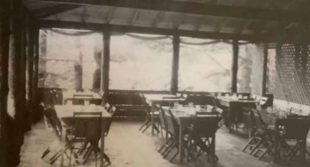
On the shores of Lake George [now called Lake Whittemore], were children’s camps. Tall Pines was founded by three siblings of the Reaveley family from Gloucester, Massachusetts in 1915. The clientele were the daughters of wealthy Bostonians who were sent to bucolic Bennington for an abundance of fresh air. Their summer included the arts, waterfront activities, hiking, theatricals, vegetable gardening, and ‘some form of useful work.’ The foci of athletics and the arts were always backed up by the emphasis of lots of fresh air– as seen in the windowless dining hall. The camp was damaged by both the Depression and the Hurricane of 1938, and attendance waned.
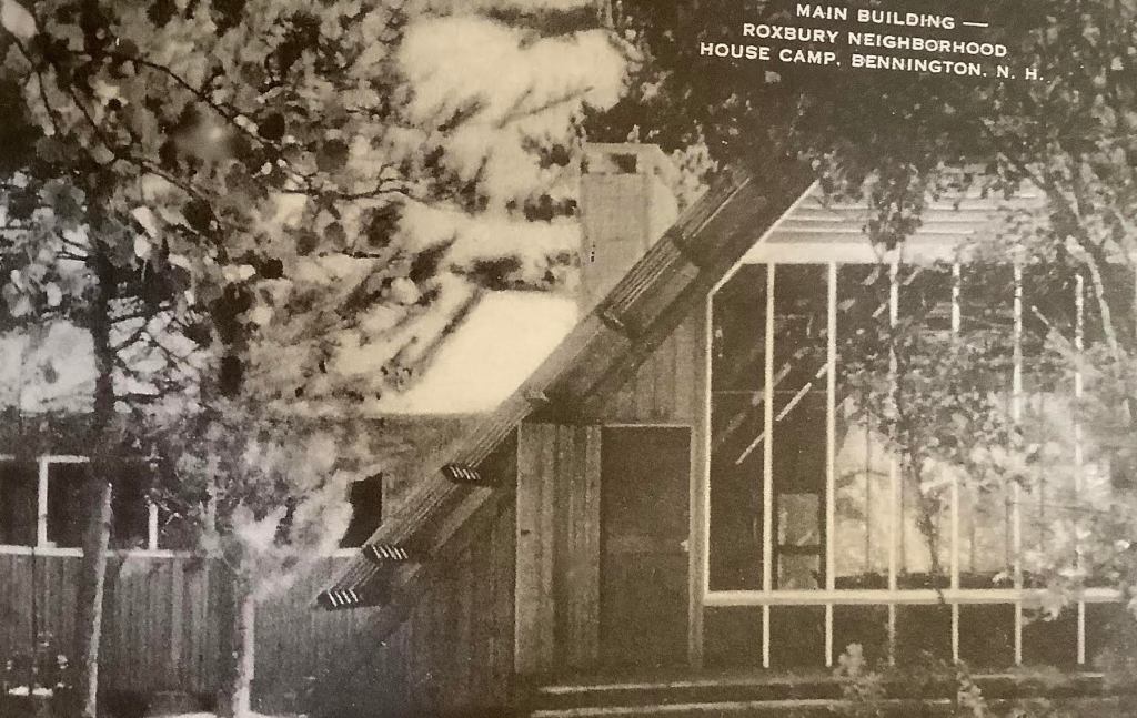
Next door, but culturally miles away, was the camp established by the Roxbury Neighborhood House of Roxbury, Massachusetts. The 120-acre location was bought by philanthropists who deeded it to the social reformers in Roxbury in 1914. They developed a camp where inner city children would stay for two-week sessions, serving 40 campers at a time in multiple encampments. This was a chance for under-privileged children to experience some carefree summer fun aways from the crowded city. Sometimes their mothers came for two or three day vacations. The racial tensions of the 1960s caused the Neighborhood House to change its focus, and the camp closed.
The next installment of the Bennington NH Historical Society Blog will be posted on July 11, 2023. If you click the Follow button, all future posts will be sent straight to your inbox every month.
When did electricity come to your town? Perhaps in 1936, when the US government passed the Rural Electrification Act, which brought up-to-date electricity to many far-flung locations. In 1882, Appleton, Wisconsin saw the first hydroelectrically-powered home, demonstrating the potential of local energy generation. Did you know that Bennington, New Hampshire was a pioneer in electric street lights?
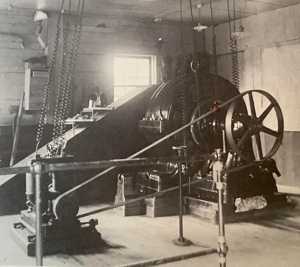
Water had always powered the town’s factories, but that changed in the late 1800s. The water rights to the river bank were formally purchased sometime in the 1870s by the Goodell Company. [The Goodell company was run from Antrim and owned mills in Bennington as well. Goodell was acquired by Chicago Cutlery in 1983.] In the late 1880s, Bennington and neighboring Antrim began a collaboration with Goodell to develop electricity for the towns. A power house was built at the third dam, wooden without and containing the latest of generators inside.
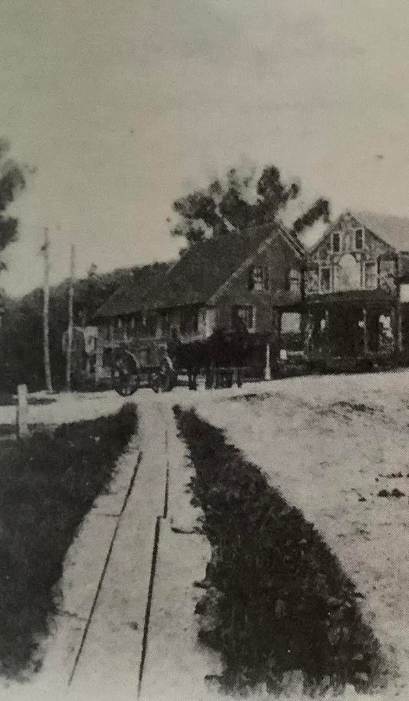
To string the wires, the first poles for electric wires were put up in the center of town, then going down Antrim Road [now called Mill Road] toward Antrim. What an excitement that must have caused! How modern the townspeople must have felt, to know that they were among the first towns in New Hampshire to have electric street lights! Looking at an old photo of the Village Center, we see wooden plank sidewalks, a horse and wagon, and electrical poles. Even the roof of the town Band Stand was used as an attachment for wires. In those days, poles and wires were not something to photo-shop out of your picture — they were an important part of the scene, showing how forward-thinking the town was.
This was not electricity for home consumption. Houses and farms were illuminated by kerosene lamps and lanterns. Many people at the turn of the 20th century feared electricity and would not have wanted it in their homes, preferring the softer glow of the lamp flame. Many of us still use those when the power goes out.
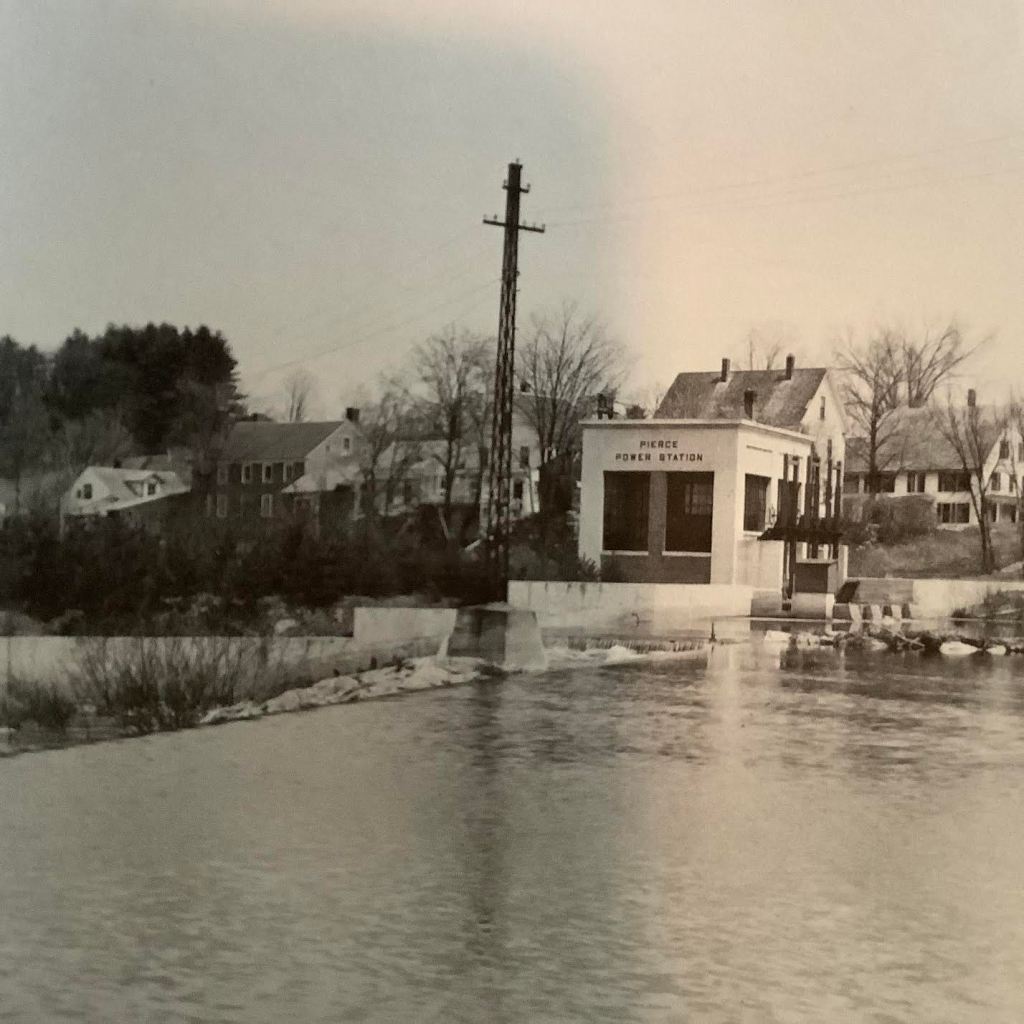
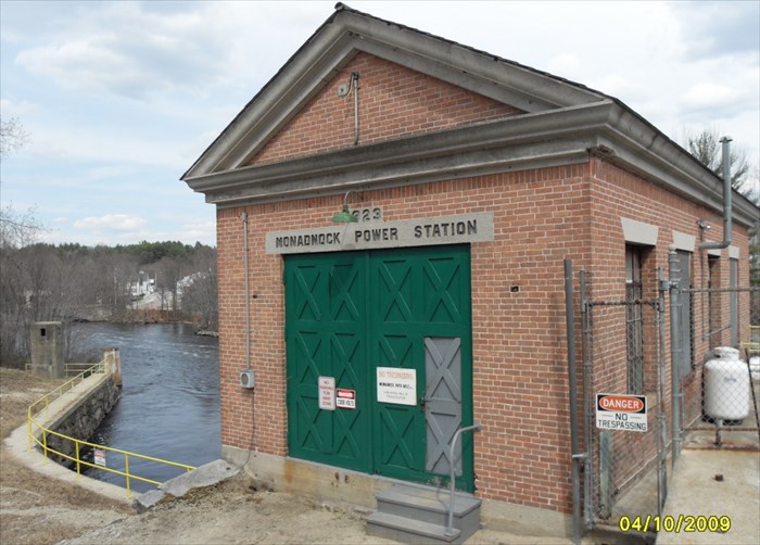
In the 1920s, Goodell’s river rights were sold to the Monadnock Paper Mill and a newer power house was built: the Monadnock Power Station, 1923, followed by the Pierce Power Station. From that point, and up to the 1950s, hydroelectric power provided the majority of the energy needs for the Paper Mill. Electrical power for the town was taken over by Public Service of New Hampshire, now Eversource.
While we laud John Putnam as ‘the first settler in Bennington,’ there have been indigenous people here in New Hampshire since the glaciers melted 13000 years ago. At the Tenant Swamp Site near Keene, the PaleoIndians had an encampment, leaving evidence of the oldest dwelling in North America. Professor Robert Goodby, who has studied indigenous people extensively, spoke about that dig to the Historical Society in 2017. In more modern times, the Abenaki were here before the 1600s, when Europeans arrived, and they are still here today. These are the people whom the Pilgrims met when they disembarked in Massachusetts [an Algonquian word] in 1620. These are also the people who sided with the French in the ‘French and Indian War’ of the mid-1700s.
The Abenaki, called the Dawnland People due to their lands in the far East of the continent, are the indigenous people of New England and maritime Canada. There were many sub-sets to the group, but they were related in their Algonquian language and culture.
Although at odds with the powerful Iroquois, the Abenaki learned from them their agricultural practice of planting the “3 Sisters” as crops. Primarily a hunter-gatherer-fisher folk, each family within the tribe would travel a singular route throughout the year, reuniting at the sea coast or a river for fishing in the summer.
Their dwellings were constructed of saplings, covered with woven mats and bark. Extended families lived in domed “wigwams,“ easy to build from found materials. The door of a wigwam always faced East, toward the rising sun. Smaller teepee-shaped wigwams were used on hunting trips, to sleep up to three. In the winter, an oval longhouse, large enough to house more people, was lined with blankets and furs for insulation. Their villages always had a longhouse for council meetings and tribal gatherings to arrive at decisions by consensus. To avoid depleting resources, villages were moved a few times a year — inland for the winter, near a water body for fishing in the summer.
Their cuisine was based on fish as the principle source of protein, along with game. Agriculture centered on the growing of squash, corn, and beans for eating fresh and for drying. Summers were spent preparing foods for the winter.
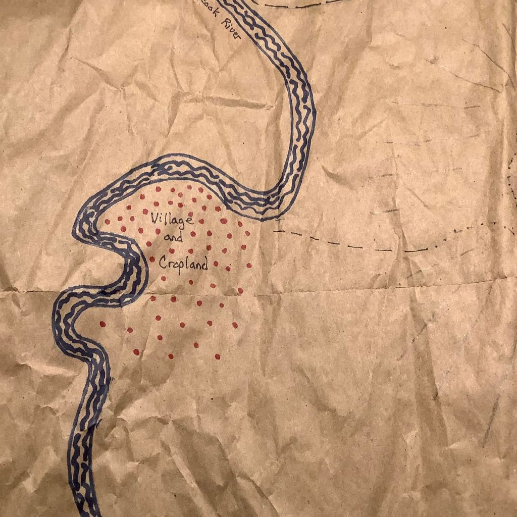
On the Right Bank of the Contoocook River, just off the Koa-wan-teg-ok Trail from Rindge to Concord, there might have been an encampment of Indigenous People.
There is anecdotal evidence that there was an Abenaki or pre-Abenaki village site in Bennington, on the banks of the Contoocook River. One can imagine the families fishing for salmon, and smoking it for future consumption. Was this a temporary encampment, used only during the salmon run? Or was it the location of a Winter village? Until the site has been studied by professionals, we will not know. Wouldn’t it be exciting to find the remains of a PaleoIndian site here?
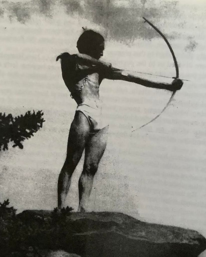
A Bennington resident named Lee Collins was an actor and model. Around 1940, he was hired for a photo shoot. The advertisement called for an image of a Native American with a bow and arrow. Did Mr. Collins have native blood? Was he the go-to model for the “Noble Savage”? In those untutored times, anybody could act as a person of another ethnic group in a film or photo, so no one would have been bothered if Mr. Collins were not an ethnic native. Local lore holds that this picture was posed at “Indian Rocks” on the old Balch Family Farm in Bennington, not far from the location seen on the map above.
Model Lee Collins, acting like an Abenaki.
The next post will be on May 29. If you click the Follow button, each monthly message will be sent straight to your inbox.
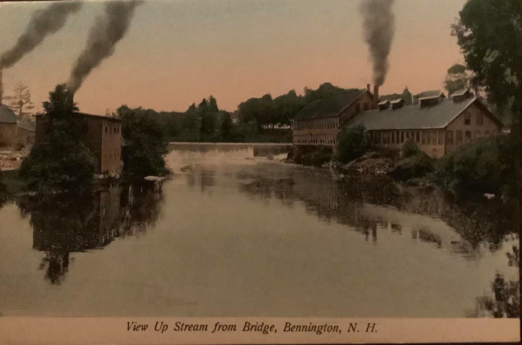
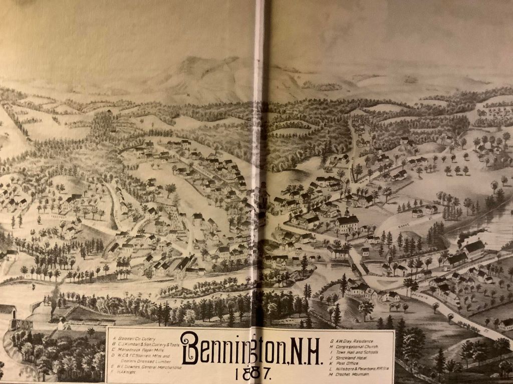
Judging from the smoke trails, one can see three active factories, viewed from the bridge over the river in the center of town. Goodell Cutlery is on the right side, just downstream of the Monadnock Dam.
Before the Town of Bennington existed, it was part of the Town of Hancock. Hancock had some running water to power some small factories, but nothing like the huge store of potential energy along the Contoocook River in Bennington. Bennington was originally planned as a site for mills.
The saw mills and flour mills of the late 1700s soon gave way to fulling mills [to turn woolen fibers into felt for hats], paper mills, and knife factories in the 1820s. Because of this, Bennington was once called ‘Hancock’s Factory Village.’ On the 1859 map, not made in any great detail, a Powder Mill [gunpowder], a Paper Mill, and a Knife Factory are shown. In the 1887 map, the Goodell Cutlery Company competed with the C.J. Kimball & Son Cutlery and Tool Company. Goodell Cutlery later moved to Antrim and most people forget that they started in Bennington. Also shown were the Monadnock Paper Mill and the W.C. & F.C. Starrett lumber mill. While the factories began by using the water as their sole source of power, the smoke in the postcard picture indicates that by the late 1800s, the machinery of the mills was powered by combustion, most likely coal.
The mills attracted workers, some of whom moved from neighboring towns, some were immigrants new to this country. Workers required housing. The three white-painted Cape-Style houses on Main Street were built by Joseph Putnam around 1800, perhaps to attract workers for his mills. On the strip of land across from the Paper Mill, between the River and the road, there used to be workers’ housing in the 1880s, since replaced by the garages of the Mill. Going up Starrett Road, one sees several identical houses on the right. When you see a row of such dwellings in a mill town, you know they were built for workers and rented to them by the factory owners.
Today, the only mill that is still operating is the Monadnock Paper Mill which has been using water power to make its products since 1819.
The next installment will be posted on May 8. If you click the Follow button, all future posts will be sent straight to your inbox every month.
Bennington began as settlements along the Contoocook River, next to the Great Falls. As the town grew, the center of the village became the intersection of two State-owned roads: 2nd New Hampshire Turnpike, [aka: Route 31] linking the town to Greenfield and Hillsboro; Route 47, linking the town to Francestown; and Hancock Road, heading South then West to Hancock on Route 137. Also: Mill Road/Antrim Road, past the Paper Mill toward Antrim; and Old Greenfield Road, going South out of town toward Greenfield and Peterborough. In other words, Bennington was a major cross-roads — odd, especially when you think that the population was less than 700 people!
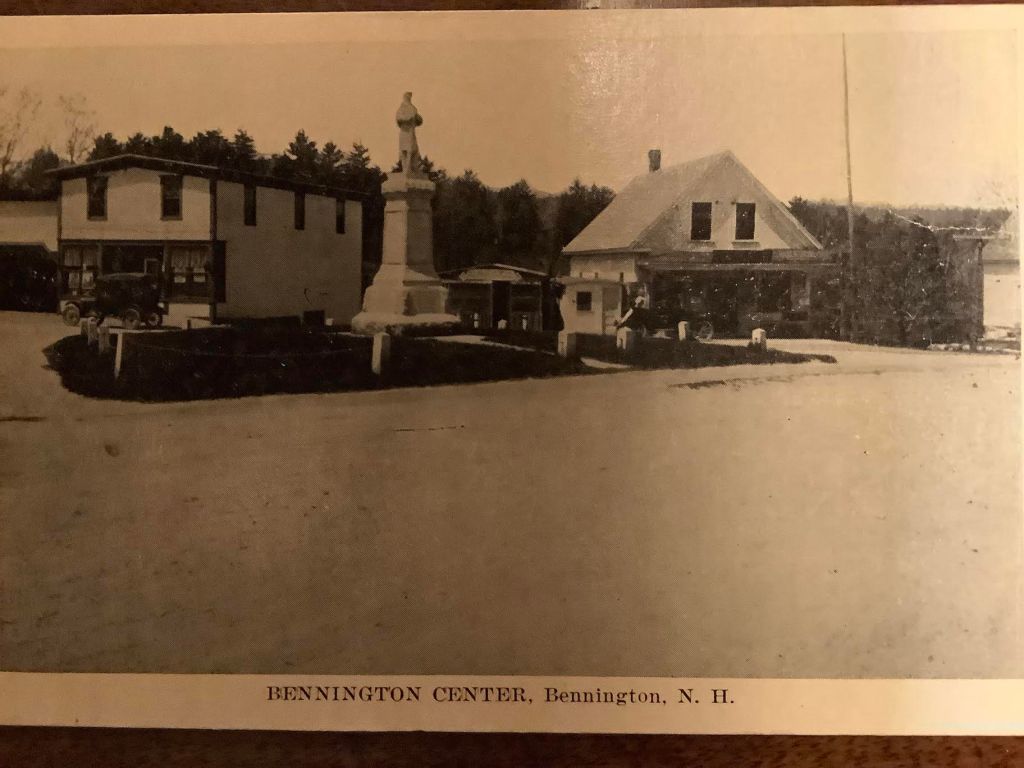
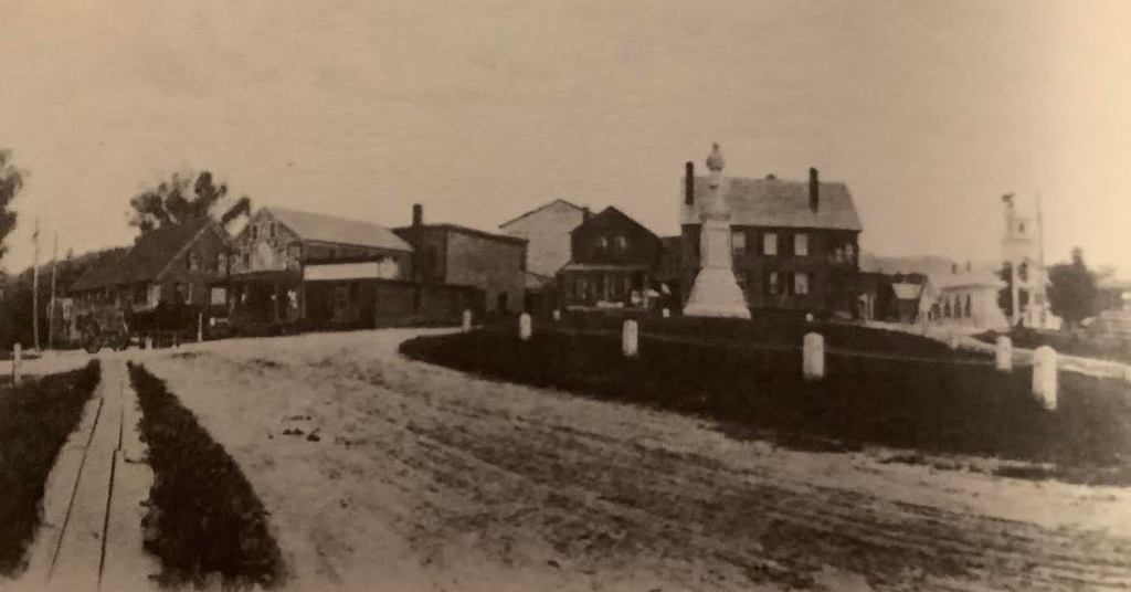
What did it look like then? The post card photo above shows a view looking North West at the center of the Village in the late 1930s. In the middle, is the Civil War Monument, erected in 1903 on a triangle of grass where most roads met. The street in the foreground, running lower left to middle right, is Main Street. The building seen at the left rear is Edmund’s Store, which originated as a ‘dry goods’ business in Bennington in 1936, before removing to Antrim. The building on the right rear was a pool hall and the very small building between them housed both an ice cream/candy store and a barber shop.
Looking North East at the center of Bennington, circa 1905.
In this view of the town center, we can see the wooden sidewalk on the left, running North. Just behind the horse and wagon at the end of the sidewalk, we see the Crystal Spring House. To the right of it is Joslin’s Store, with its colorful facade. The large house with two chimneys behind the Civil War Monument is the Adams Hotel, and the white building in the upper right is the Congregational Church.
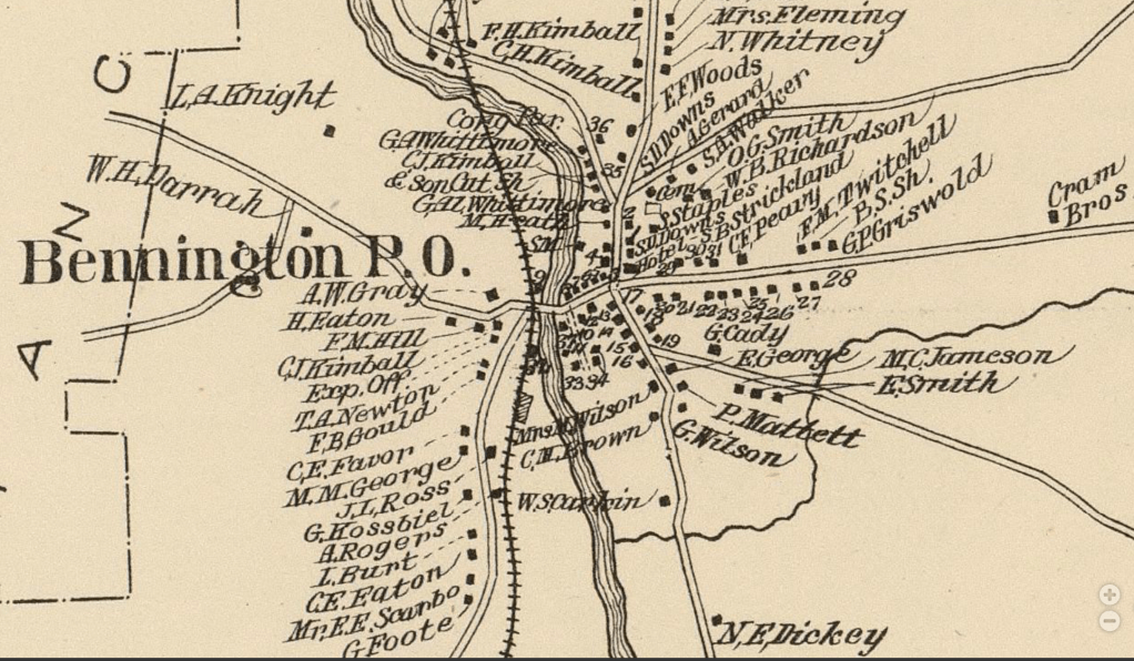
A map from 1892, shows Main Street running North-South, crossed at #17 by Route 47 on the East, and Hancock Road going to the West, then turning South once it crosses the river. At that time, there was no Route 202.
The next installment will be posted on April 17. If you click the Follow button, all future posts will be sent straight to your inbox every month.
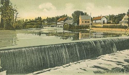
A view from a 1905 postcard showing one of the dams on the Great Falls of Bennington. In the foreground, is Pierce Dam, the 3rd of the falls. Just under the iron bridge in the center, you can see water splashing over Monadnock Dam, the 2nd of the falls.
Over a distance of 1.2 miles, in the center of Bennington, New Hampshire, the water level of the Contoocook River drops seventy feet. The glacier that retreated around 10000 years ago formed the terraced landscape over which the river flows. That source of power at the “Great Falls of the Contoocook” is what induced Joseph Putnam in 1782 to purchase land on the east side of the river for the construction of a grist mill [a mill for grinding grain into flour]. At that time, there was no town called Bennington in the state — the land was in the town of Hancock. In the 1700s, the energy of falling water was the principle source of power for machinery. Settlers in the Americas were always looking to live where there was water tumbling down the smallest incline. At the Great Falls, there was not a single ‘falls’ like Niagara, but a series of four locations where the water went down hill, falling 10-12 feet at each site. This series of rapids falls over the remains a glacial moraine, which was breached by a tremendous flow of water at the end of the last Ice Age.
To harness the power, dams had to be built. For the purpose of discussion, I have numbered the dams 1 through 4, to show their position on the river, not the order in which they were built. Dam 1, the Powder Mill Dam, is the farthest South, which is upstream of the town. In 1823, the Dam was built at the North end of Powder Mill Pond, creating that large body of water. Dam 3, called the Pierce Dam, is the oldest, built by Putnam. Joseph Putnam’s dam was downtown, across the road from his house. [on the Google Map that is shown in the link, the dam is just above the words ‘common place’] Just upstream from that is Dam 2, known as Monadnock Dam. High Gate Dam, #4, is down-stream, across from Alberto’s Restaurant, near the Monadnock Paper Mill. None of these spillways looks terribly dramatic, but together they store a lot of potential energy which powered many big and little mills around the town in the 1800s and early 1900s. Since 1932, there has been a hydroelectric plant at Pierce Dam. Falling water is still a source of energy.
Hancock was founded in 1779, Francestown in 1772. Then there’s Antrim in 1777. So how come Bennington didn’t become a town until 1842?
Come back in time with me to the early 1600s, and I’ll tell you the story… As you read, count up how many different names the place now known as ‘Bennington’ has had in the past.
John Mason, of England, was very interested in the New World. In 1620, King James I drew lines on a map of North America and gave a large chunk to Captain Mason. This property ran from Cape Ann, Massachusetts to the Merrimack River. He named it “Mariana.” By the time of his death in 1635, Mason had a claim to extensive lands in New Hampshire, from the ocean to the sources of the Piscataqua and Merrimack Rivers.
For the next hundred years, his claim was fought over in endless title disagreements until a group who called themselves the Masonian Proprietors bought a clear title from Captain Mason’s son, John Tufton Mason, in 1746. Much of the land in southern New Hampshire had been divided into towns by then, except for an area on both sides of the Contoocook River. They called that region “Company Land” or “Society Land.”
These men were land speculators: they bought up land so they could sell it for a profit. Already 35 towns had been formed from Mason’s original land. As they poured over the maps, the Proprietors saw that one area was still unsettled. It was on the river, and that was a plus, but the land was rugged. Being dominated by a tall mountain, the parcel was not great for farming.
The Proprietors divided this remaining land among themselves, into fifteen plots which ranged from 500 acres to 1000 acres. By the 1770s, European settlers felt that it was safe enough to move into this area. Francestown was established in 1772, and named after colonial Governor Wentworth’s wife Frances. Deering, named for Frances Wentworth’s middle name, came next in 1774. As the Revolution seethed, Scots-Irish residents in Society Land formed Antrim in 1777.
The rushing, tumbling falls of the Contoocook River presented a problem to settlement which no one could bridge. When Hancock was granted the rights of a town, its border was the River. Land east of the River was yet unsettled. As the 1800s dawned, the only remaining part of Society Land which was not a town was a small area between Crotched Mountain, Francestown, and the River. This had been called “Great Lot Number Nine” when the land was divided among the owners of Society Land.
The first European settler in our town was Joseph Putnam who arrived in the Fall of 1782. His family had founded Wilton and Lyndeboro, and now Joseph was looking for a site for a water-powered saw mill to provide lumber to the new population. He bought the title to the land from his brother who had been the first European to visit the Falls. Soon, he built a house where Pierce School is now, having a farm, a dam, a saw mill, and a grist mill. He bought more land and the water rights to the river, and most importantly, he built a wooden footbridge to the Hancock side of the river. Before 1800, 12 or more other families settled in what was known as Putnam’s Mills. These families included Colby, Dodge, Huntington, Parker, Wilson, and Eaton, to drop a few familiar names.
The population waxed and waned but never really grew much due to Putnam’s exclusive property rights. Although there were no more than 30 families, they elected selectmen, appointed constables, and held town meetings at Putnam’s house. From 1785 on, petitions were made to the State Legislature to incorporate or to join neighboring towns. Putnam and his land joined Hancock prior to his leaving the area. This created problems for the remaining residents: no local church, no town hall, no local school, no local post office, no businesses except family farms.
But after Putnam left, new mills and industries grew up along the river, run by the Whittemores and the Burtts. This attracted a greater population to work in the cotton mills, the saw mills, the hotel, the woolen mill, the fulling mill. The area, still part of Hancock, was then called Hancock Factory Village. Home industries included paper making and gunpowder manufacturing. The first church was built in 1826, and the town had a building boom in the 1830s. New roads and new bridges lead new people into the not-yet-a-town.
In 1842, after simmering disputes with Hancock over school, liquor laws, and feeling like second-class citizens, John Huntington asked the State Legislature for an independent town of their own. Hancock voted against this at their next Town Meeting, but that did not stop the rising tide of secession. To make the town boundaries large enough to qualify as a town, parts of Antrim, Francestown, Deering, Greenfield, and Hancock were shaved off. At last, on December 15, 1842, Bennington was incorporated as the newest town in New Hampshire.
Why was it called “Bennington”? Was it after Governor John Benning Wentworth who died in 1770? Was it in honor of the Battle of Bennington [Vermont] in 1777? Was it named by US President Franklin Pierce after the road where his friend was killed in a duel? Oddly, no one seems to know, although the connection with the Wentworth family seems likely. Yet why would people who so recently won their independence want to be linked to a colonial governor? We may never be sure why the name was chosen, but Bennington we have been since 1842, and Bennington we will remain.
This is the blog of the Bennington Historical Society in Bennington, NH.
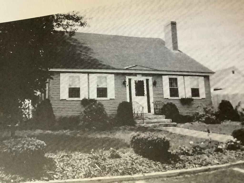
Putnam house, after some additions, c. 1930sThe house today, after being ‘restored’ to its origins as a Cape-style building.
Built in 1783, this is said to be the oldest house in Bennington, NH. It was constructed by Joseph Putnam, the first settler of European descent. Putnam, from Wilton, NH, had purchased the land along the river with the dream of building a grist [flour] mill and a saw mill powered by the falling water. After building the mills, he milled boards to construct his house. Within the year, his wife and children joined him there.
The style of the house is a Cape Cod, a common building of the early days. It features a full main floor and a half-story above. Originally, it would have had a center chimney. The size of the house made it relatively easy for one man to build. On the ground floor, there would have been a kitchen/great room and a bedroom. The upper floor, accessed by a ladder, would have been an unfinished loft for food storage and the sleeping space for children. In time, stairs would be added and the loft would be finished into rooms.
In an upstairs closet of the Putnam House, the floor includes a board made from a “King’s Pine,” a tree of great height and girth that had been marked as property of the King of England for the purpose of being made into masts for the British Navy. Early settlers, before and after the Revolution, cheerfully cut down these trees (illegally), to use for building their houses and to tweek the nose of the British. One might presume that this board is all that remains of wide boards once seen throughout the house.